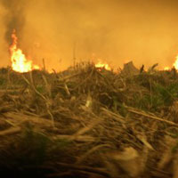
El Nino’s arrival has brought on severe drought to the region. During these long droughts, the forests of Borneo are much more vulnerable to fires. The land cleared for palm… Continue reading OFI fighting fires in Borneo
OFI at the 25th Annual ESRI International User Conference
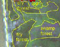
“GIS – Helping Manage Our World” – The ESRI (Environmental Systems Research Institute) International User Conference (UC) is the biggest GIS (Geographic Information System) event of the year and thousands… Continue reading OFI at the 25th Annual ESRI International User Conference