Tags:
GIS Mapping
A new conservation project focused on Geographic Information Systems (GIS) is under way at Tanjung Puting National Park. GIS is a digital mapping technology used to store and analyze geographic information. This technology is especially useful for conservation planning because it helps people understand, synthesize and communicate many different layers of information about a conservation area. At Tanjung Puting, one of the goals of GIS will be to map intact forest and prime orangutan habitat as well as areas of logging and agriculture in order to identify and plan for areas where management is most needed.
GIS work began in October, 2003 as part of a USAID grant awarded to OFI and World Education (WE). Since then, a team of 12 volunteer GIS analysts have assembled a system of computer hardware and software, compiled existing hardcopy and digital maps and acquired satellite imagery for the park area. In March, maps were produced and taken into the field for initial ground-truthing, data collection and planning.
The goals of field work were to collect primary data which could be compared to existing mapping and imagery, test equipment and plan for more extensive field work in June. We brought maps of existing land cover mapping and satellite imagery into the field and collected new data using GPS. The field team collected data at selected forest, logging and agricultural areas along four main rivers on the west side of the park – Sungai Cabang, Sungai Buluh Kecil, Sungai Lulut and Sungai Sekonyer.
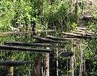
At Sungai Cabang, the field team mapped the river, village and nearby agricultural fields that border the forest. GPS data for these places will be compared to satellite imagery to help identify and map other areas of clearing and agriculture that cannot be accessed or might be missed by field mapping on the ground. The village at Sungai Cabang was established before Tanjung Puting was created, and now World Education is helping villagers develop sustainable agroforestry there. This type of agriculture is designed to curtail slash and burn practices, and provide a biologically valuable buffer for the surrounding rain forest.
In contrast to small-scale agroforestry at Sungai Cabang, dry rice cultivation at Sungai Lulut has converted hundreds of acres of forest inside the park to barren grassland and fallow fields. Stripped of forest trees, nutrient-poor soils and invasive weeds covering abandoned farmland prevent forest from re-establishing. Forest conversion at Sungai Lulut continues to be a significant threat to habitat conservation at Tanjung Puting. Every year new agricultural plots are burned and cleared by increasing numbers of immigrants to this illegal village.
Based on initial analysis of satellite images, forest conversion to agriculture has increased significantly between 1993 and 2003 along the west coast of Tanjung Puting. Also visible on recent imagery are hundreds of small clearings infiltrating the forest from agricultural lands. Monitoring this border to stop further encroachment is one of OFI’s priority goals over the next year and GIS maps will be used to help plan and communicate management actions. Along the Sungai Buluh Kecil the field team mapped a different suite of forest characteristics and degradation. In the primary swamp forest surrounding the Sungai Buluh Kecil, water covers much of the forest floor during the wet season making it nearly impossible to distinguish river from seasonal lake. While this watery forest has not been subject to agricultural encroachment, easy access to prized hardwoods has led to extensive logging in the area. We navigated and mapped one of the abandoned logging canals once used to move logs out of the forest and to market via the Sungai Buluh Kecil.
The field team collected GPS data at dozens of locations in the surrounding swamp forest, recording information about standing water, forest canopy density and logging disturbance. These data will be related to satellite imagery in order to identify and map different types of forest cover and logging disturbance in Tanjung Puting. One goal of this mapping will be to quantify the extent of intact primary versus logged forest.
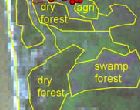
Fifteen kilometers north, on the Sungai Sekonyer, we recorded the greatest diversity of natural habitats as well as a new type of environmental degradation. The Sekonyer is a wide, long river that forms the northern boundary of Tanjung Puting National Park. Its main branch is highly sedimented from gold mining operations that have stripped away forest in certain locations along the river. We stopped at the largest gold mine – Aspai and recorded GPS locations. This barren, sandy area is very distinctive on the satellite imagery and one of the next tasks will be to search for similar, smaller gold mining operations further east along the Sekonyer and its tributaries using satellite imagery.
Despite the poor water quality of the Sekonyer, much of the surrounding forest supports an amazing diversity of wildlife. From the river we observed proboscis monkeys, agile gibbons, macaques, hornbills, and a number of other birds moving around in the forest canopy above. On the Sekonyer Kanan, a south-branching tributary, the river narrowed, the water ran black and we mapped primary swamp forest again up to Camp Leakey.
The Camp Leakey research area includes a diversity of forest habitats including mangrove, wet swamp forest and some of the best examples of dry lowland forest in Tanjung Puting. Some areas near camp had been cultivated or selectively logged in the past so we were also able to observe and record various successional stages of forest and open fern/grassland. These vegetation types were recorded along trails using GPS which can now be compared to satellite imagery using GIS in order to map different vegetation types.
The field team also began recording GPS locations for more detailed mapping at Camp Leakey including buildings and trails. These data may be used to produce guide maps for volunteers and visitors to the camp. Extensive long-term research data, especially those collected on orangutan follows, may also be tied to a trail database for the Camp Leakey research area so that a wide variety of biological information such as tree-fruiting times and orangutan movement can be mapped. These GIS maps would provide the basis for understanding and visualizing how animals and plants are distributed relative to different vegetation types in the reserve. This information will be valuable to researchers and conservation managers since these observations may lead to a better understanding of the ecological processes driving these spatial patterns.
After a short week of field data collection, it was time to return to the GIS lab, download GPS data and start adding these observations to the GIS database for comparisons with satellite imagery. Based on field data, the GIS team is in the process of creating new land cover maps, conducting initial analyses of recent vegetation change, assessing the accuracy of existing data and preparing for a more extensive field collecting trip in June, 2004.
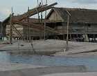
The June field trip will be focused on collecting data representative of all land cover types in Tanjung Puting and collecting more detailed data in selected locations. Two teams of six volunteers will spend a month using GPS to record representative locations for all land cover types in order to refine land cover maps. We will also visit areas where no accurately mapped data currently exists, including the completely inundated swamp forest that covers the southern third of the park. Detailed data will be collected in agricultural areas including large-scale rice plantations in the western part of Tanjung Puting and extensive palm oil plantations along the northern border of the park. Logging canals still operating in the eastern part of the park will also be visited so that these critical boundary areas can be mapped and more effectively patrolled.
As the database expands and improves, and as support and training are moved to local conservation managers, GIS will become an increasingly useful tool for conservation planning at Tanjung Puting. GIS analysis of satellite imagery will enable managers to develop a better understanding of the pattern and extent of forest change in the park over the past decade. And up-to-date imagery together with an existing GIS database will enable conservationists to target areas where management is most critical.
GIS work supported by Dr. Janet Franklin’s Ecology Lab, Biology Dept., San Diego State University

