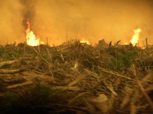
OFI fighting fires in Borneo
Tags:
Fires GIS MappingEl Nino’s arrival has brought on severe drought to the region. During these long droughts, the forests of Borneo are much more vulnerable to fires. The land cleared for palm oil plantations and by farmers goes up in flames easily due to the dried and dead brush on the floor of the forest.
What is OFI doing?
Our office in Pangkalan Bun uses a GIS, which is a Geographic Information System, to locate hotspots in the area. OFI then provides the local forestry department with updates on these hotspots so they can take action to prevent fires.
OFI also is a member of the local government commission which manages fire-fighting in the region and works closely with other government agencies in fire-fighting efforts. Right now 50 assistants from our OFI facilities in Borneo (Orangutan Care Center and Quarantine and other field locations) are fighting fires night and day in the Tanjung Puting National Park. They are dedicated to this work and may go for days on end without sleep and change of clothes.


